
City Of Charleston Land + Water Analysis
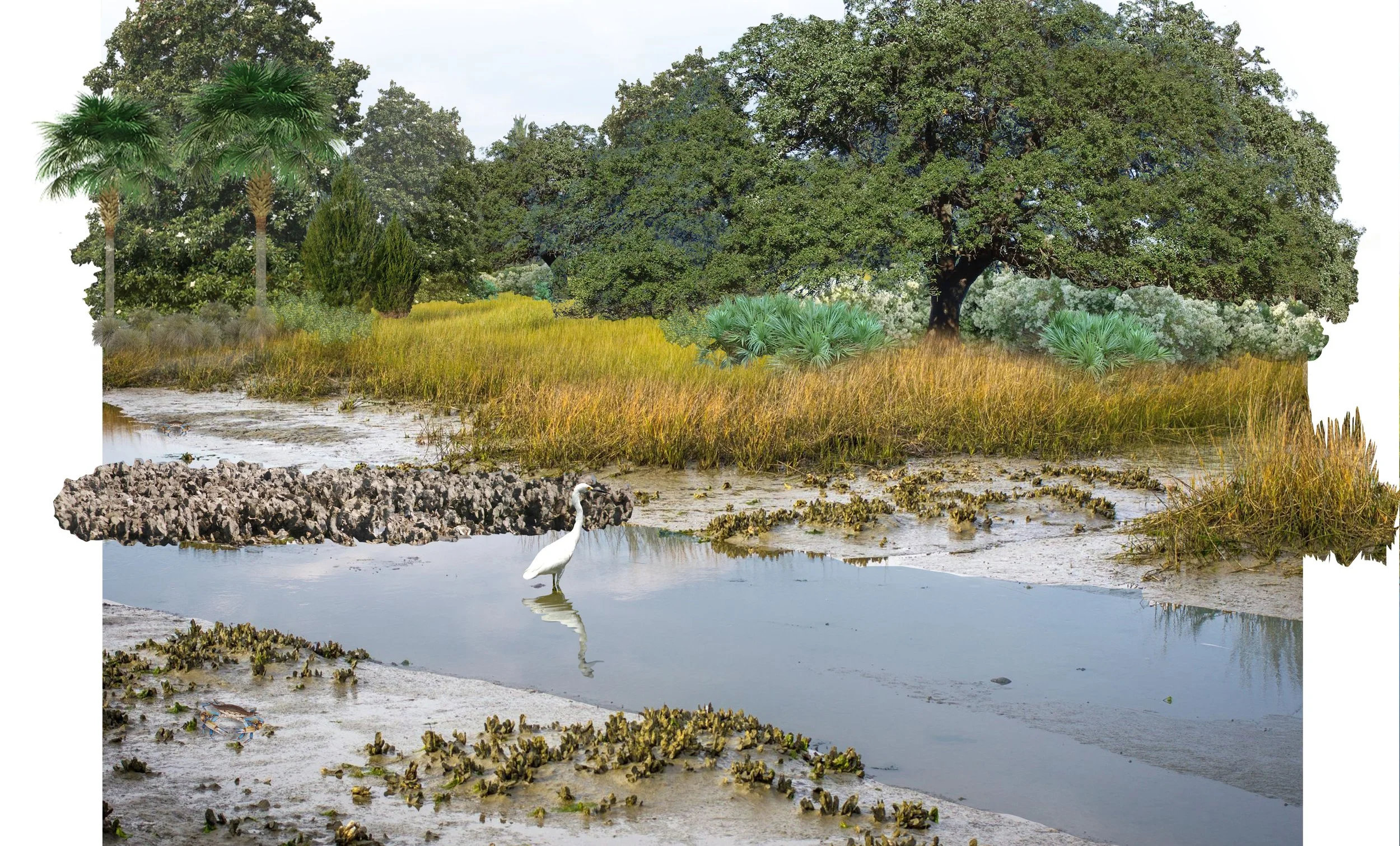
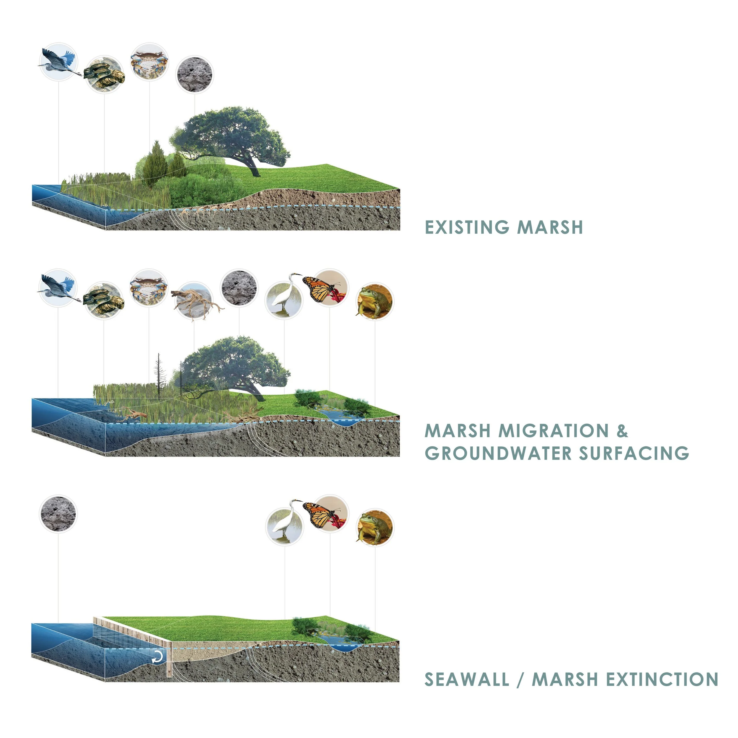
Surculus was included as a local consultant on the team tasked with translating outcomes of the Dutch Dialogues (TM) process into recommendations for the City of Charleston’s updated Comprehensive Plan to create a more resilient relationship between land and water throughout the City’s varied geography. As part of the analysis surrounding marsh migration, Surculus developed graphics to illustrate implications for various responses to erosion and sea level rise (namely structural vs. adaptive), when considering the economically, ecologically, and culturally critical estuarine salt marsh.
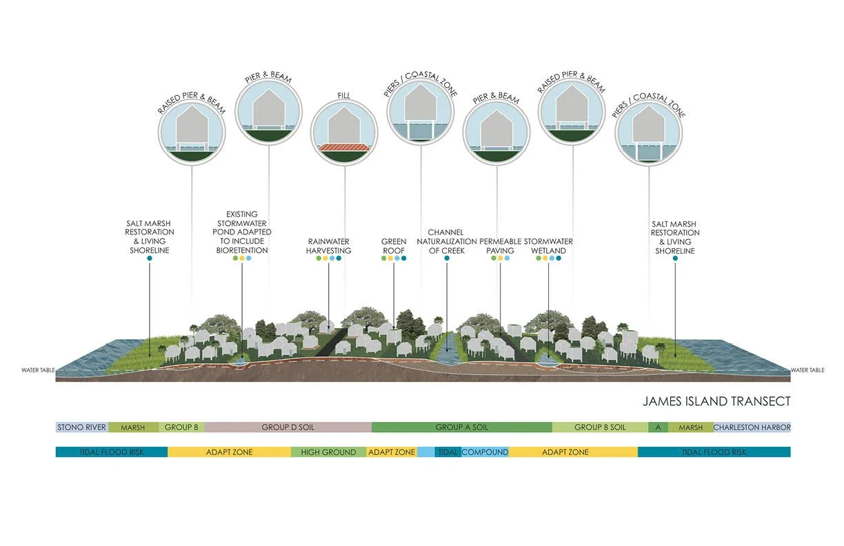
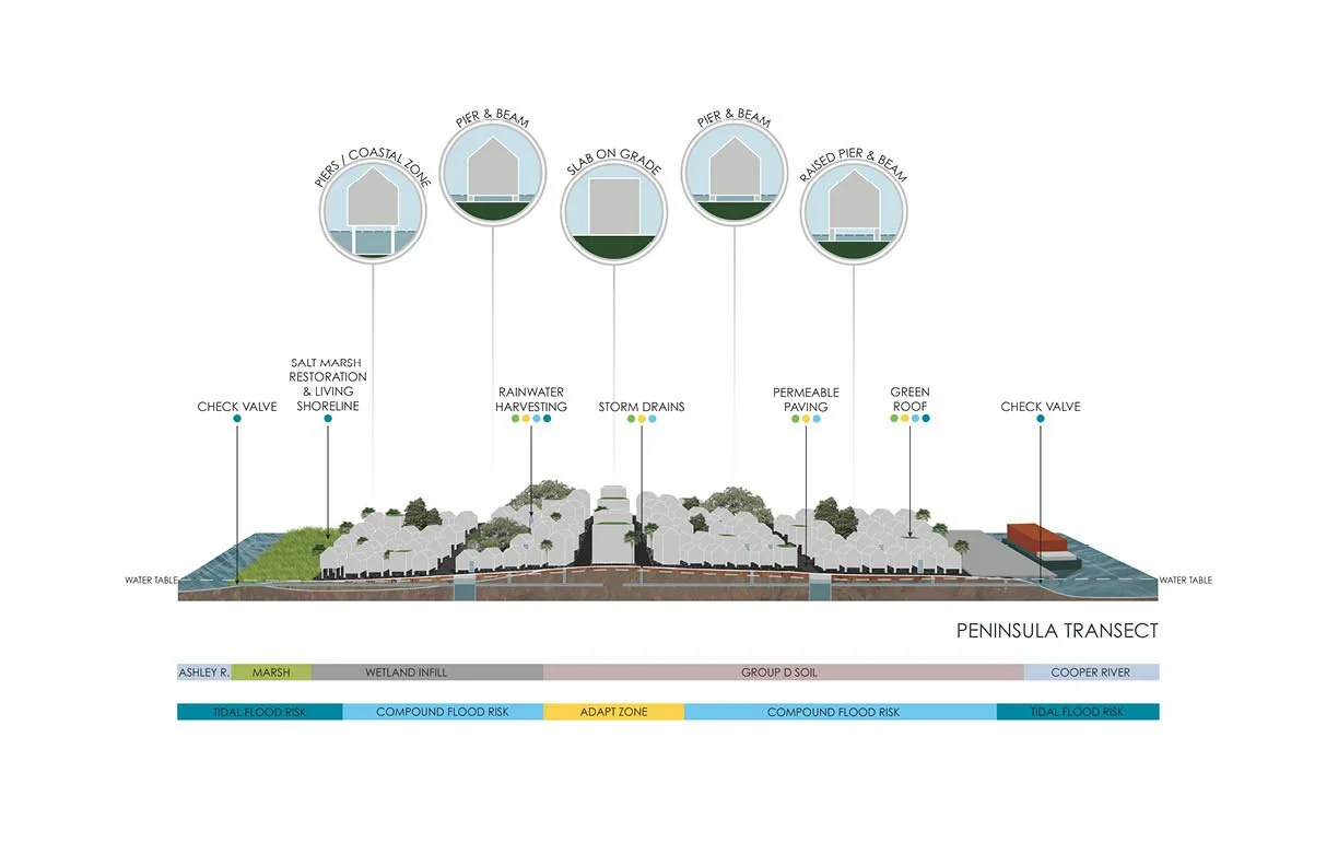
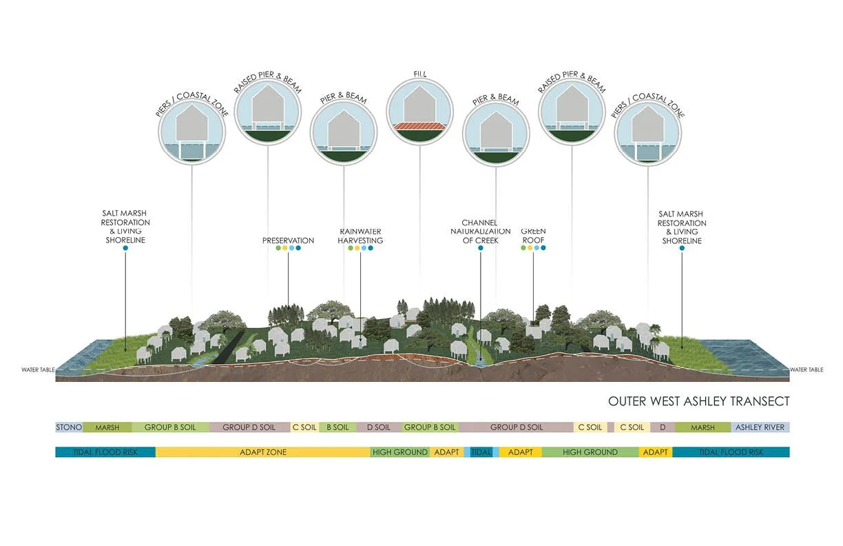
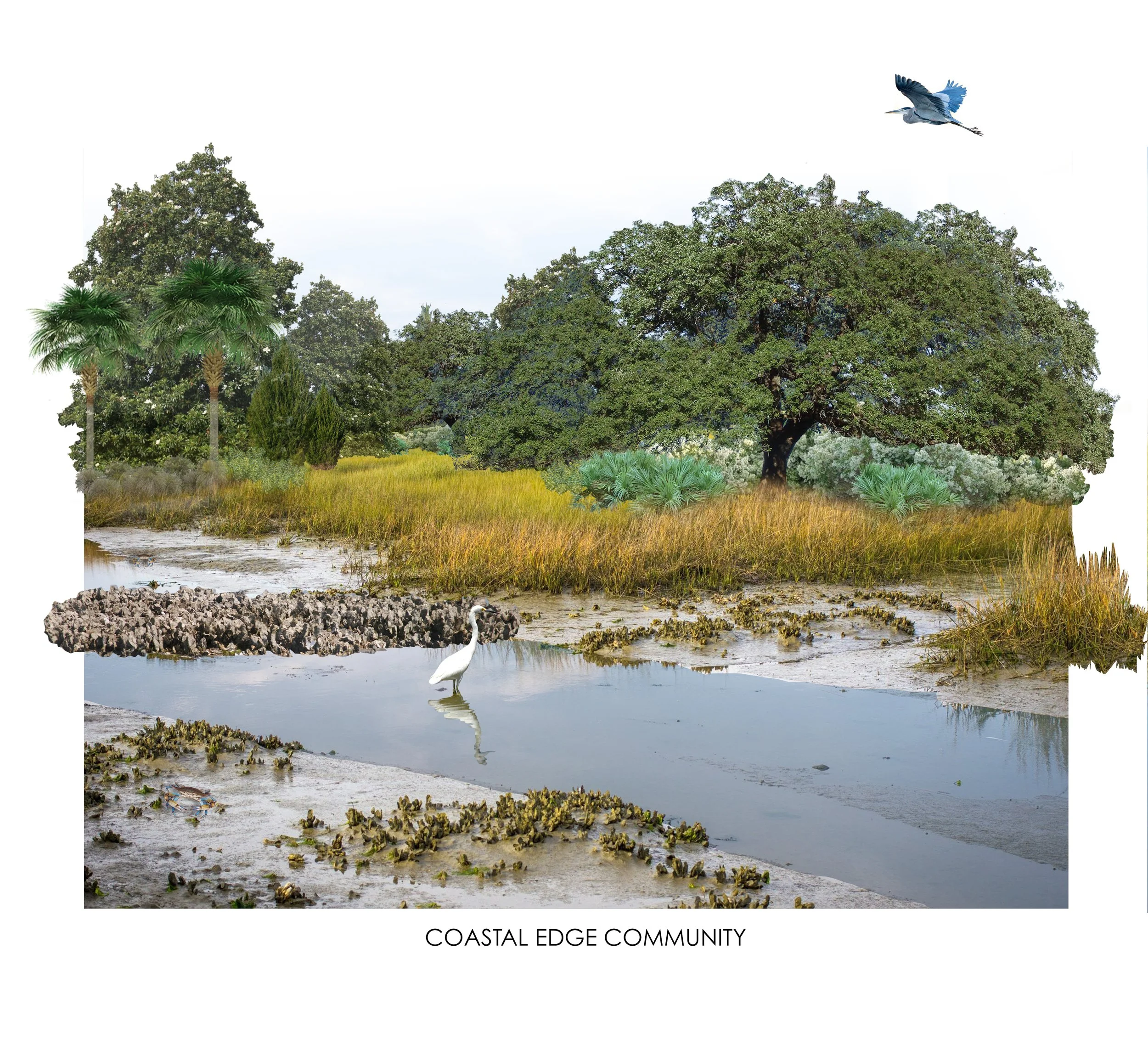
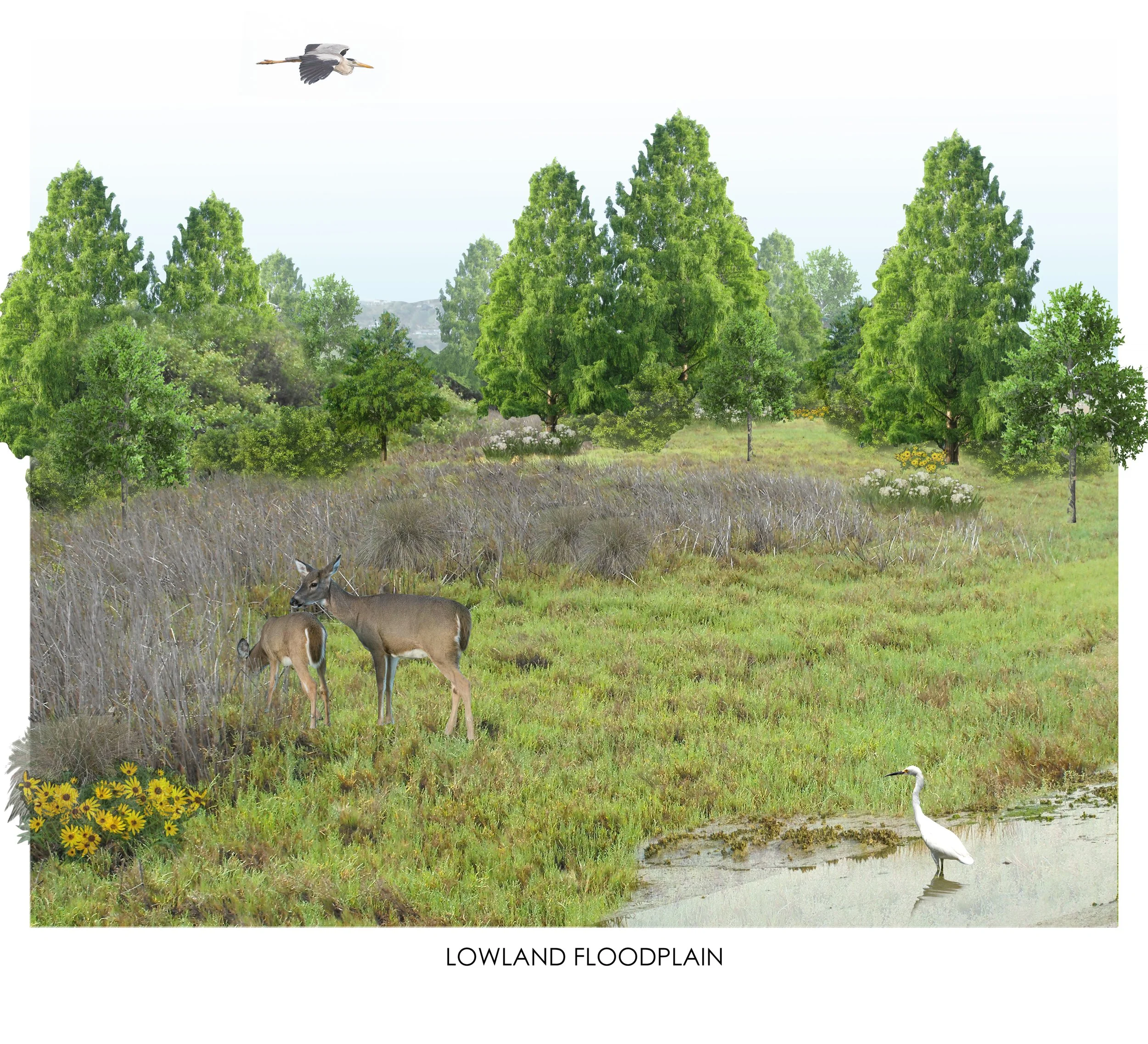
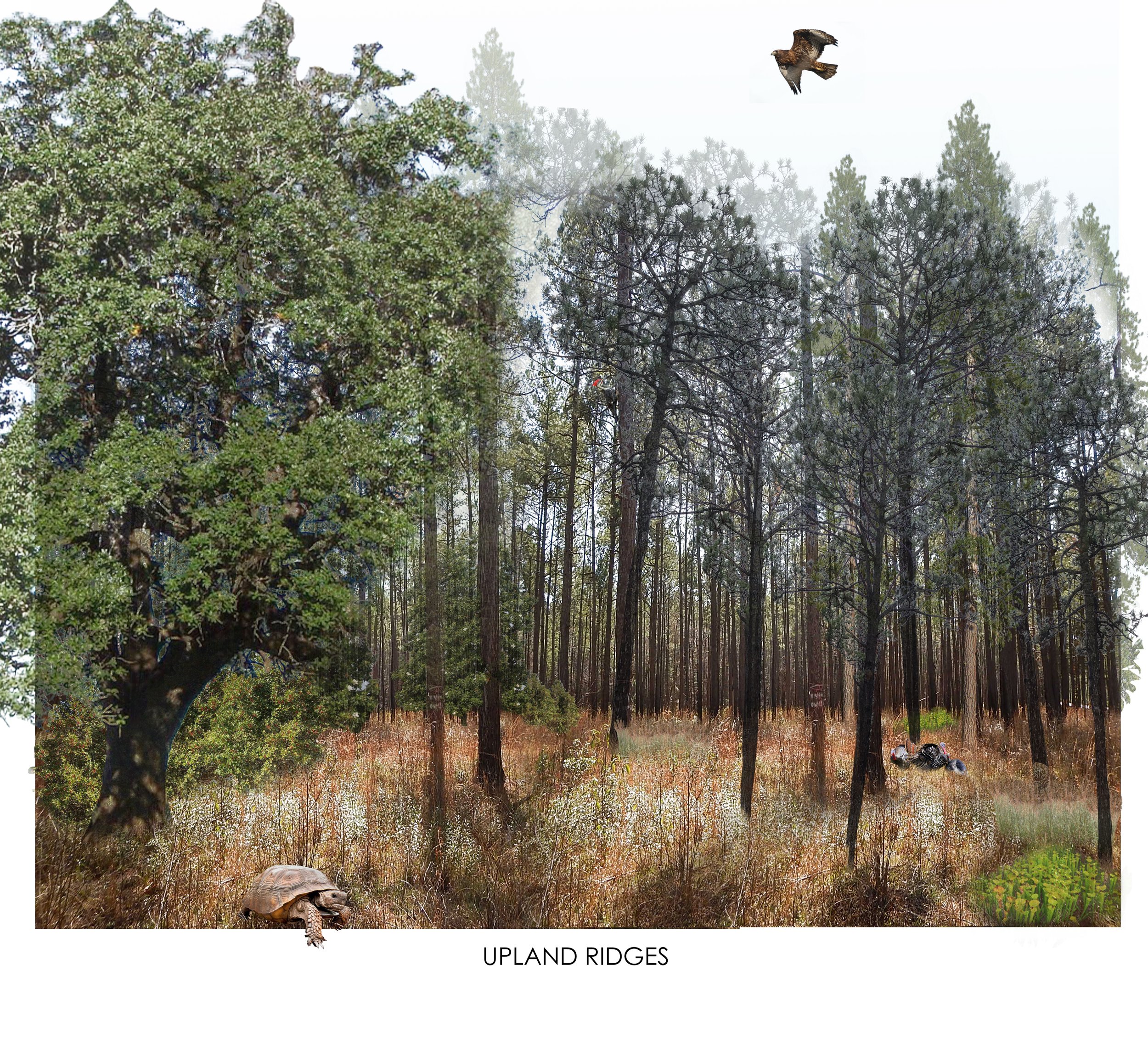
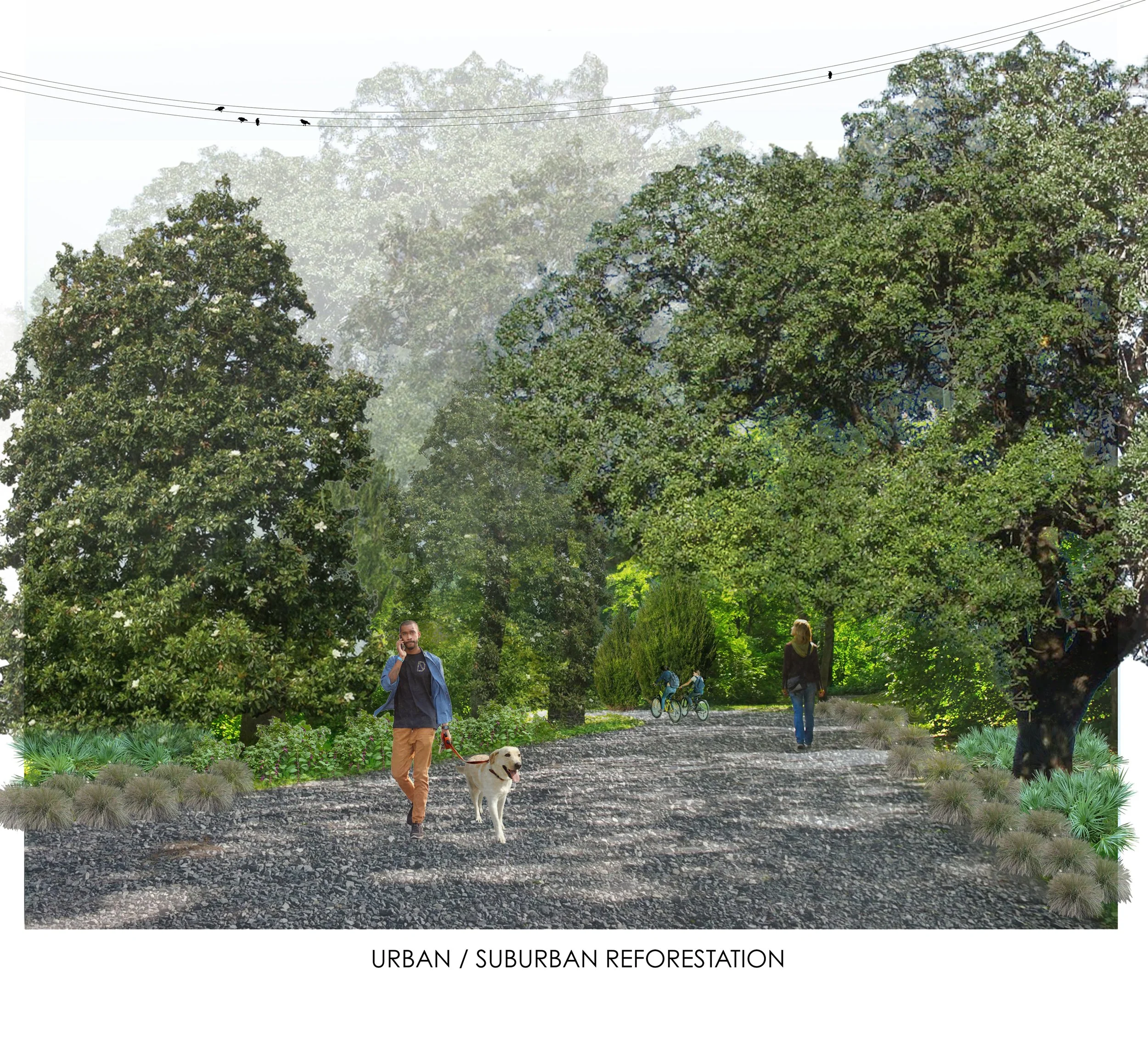
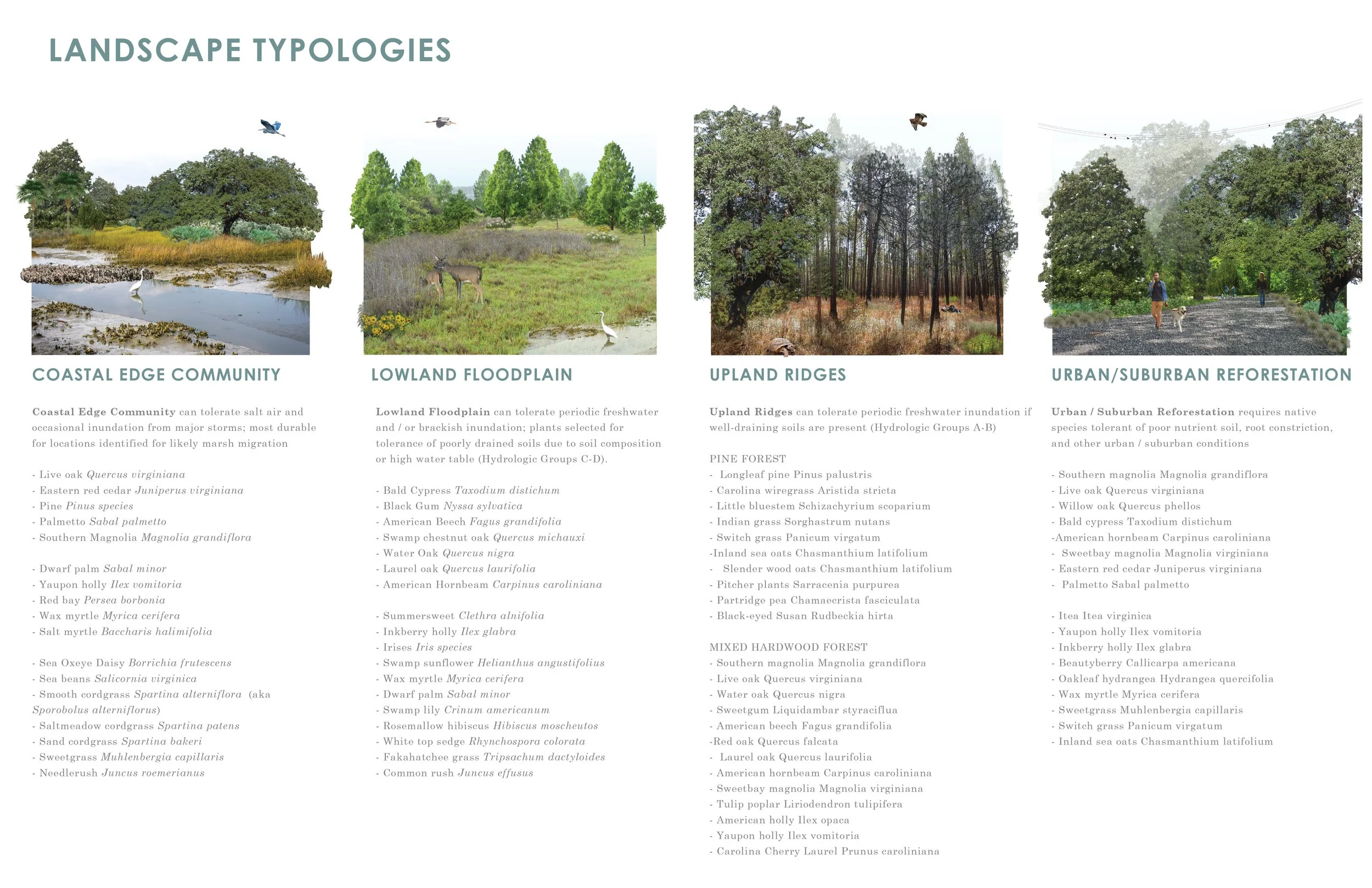
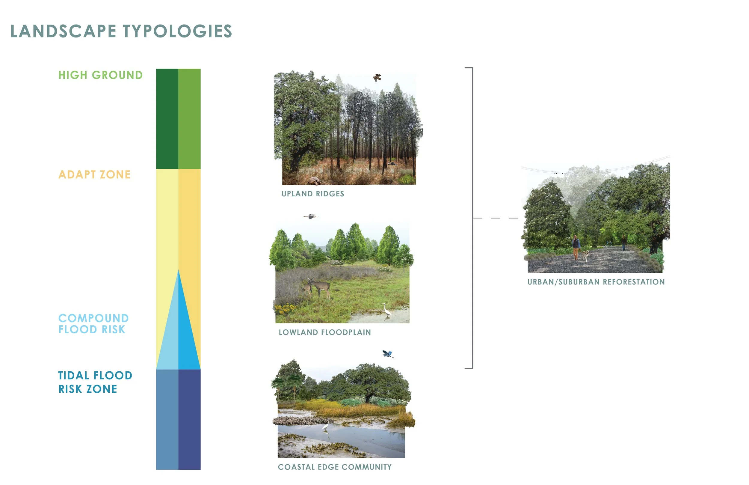
With input from the other consultants on the team, Surculus also developed a series of landscape typologies common throughout the City’s geography complete with a list of key plant species for each typology. The intention is to help inform future zoning requirements and lists of municipally-approved plants to emphasize the varying ecosystems within the City limits. These typologies were correlated with identified Risk Strategy Zones and Water Management Measures to create contextually relevant guidance for engineers and landscape architects working within the municipality. The Team also developed graphic transects to further ground these strategies in the specific zones of the City’s geography. A selection of analysis graphics is included below, and the full document is available online: Charleston Land + Water Analysis
Client: City of Charleston
Project Team: Waggoner + Ball (Prime) with Subconsultants Surculus, Robinson Design Engineers, and The Water Institute
Surculus Role: Local Insight, Landscape Typology Development, Graphic Support, Community Engagement Support